Precision Marine
Precision Marine
The range of professional smart antenna GNSS RTK solutions compute precise positions up to 1 cm accuracy coupled with precision headings within 0.01 degrees to a range of commercial solutions with precise positions up to 2.5 meters with headings within 0.5 degrees. The range of smart antenna features allow the user to self-configure either as base station or rover for a wide range of industry applications.
ComNav’s GNSS Position & Heading products are compatible with built-in industry standard interfaces including UHF SATEL radios, Cel modems, Wi-Fi, Bluetooth, NMEA 2000, NMEA 0183, Ethernet, CAN and in some models, the products are IMO compliant and Wheelmark certified.
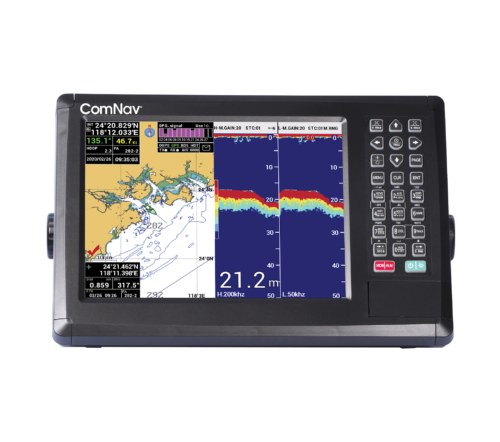
M10-CF GNSS Chart Plotter FishfinderNEW
- 800 X 600 resolution and wide angle of view.
- Supports GPS, BEIDOU and SBAS (WAAS, EGNOS, MSAS, GAGAN).
- Provide AIS input interfaces to connect with AIS device conveniently and display AIS targets dynamically on the chart.
- Echo Sounder transmit power is 600W and transmit frequency is 50KHz / 200KHz.
- Conform to IP65 water-proof standard.
- Intelligent automatic operation mode in Echo Sounder mode, such as automatic seabed tracking, auto range, auto shift, auto gain control.
- Pre-built-in global reference chart which can be upgraded regularly.
- Floating GND power design, more stable and reliable
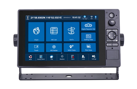
M10 GNSS Chart Plotter Fish FinderNEW
- Chart Compatibility: Supports chart formats such as C-MAP (Max), S57, S63, CJ57, and CJ63.
- Digital Repeater Dial: Features a new digital repeater dial for clear and visualizable display of parameters like HDT, COG, SOG, BRG, RNG, Longitude, Latitude, XTE, ETA, DPT, TEMP, Wind, and Date.
- Six modes of display
- GNSS Accuracy: Utilizes ephemeris combined with histogram for GNSS satellite monitoring and signal strength visualization; supports GPS and BDS positioning systems for improved accuracy.
"Highly accurate attitude information as she precisely tracks like an arrow in all sea and weather conditions... "

